
 Translate
Cedar River - Lake Washington Watershed
Information and services within the drainage area that includes the Cedar River and Lake Washington. Includes lakes, streams, wetlands, fish and wildlife habitat, pollution, flooding, open space, and forestry in the area.
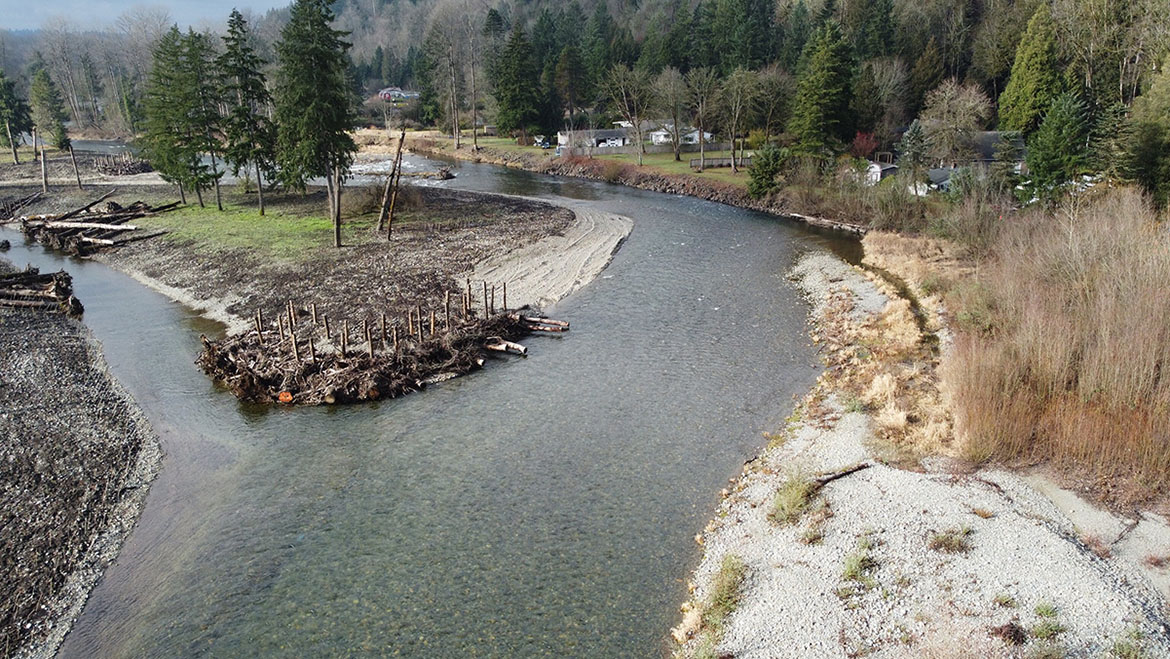
The Cedar River - Lake Washington Watershed is the land area in which rainwater drains to Lake Washington and out through the Hiram Chittenden Locks. The Cedar River - Lake Washington watershed includes the Cedar River and its tributaries, May Creek, Coal Creek, Mercer Island, Mercer Slough, Kelsey Creek, Fairweather Creek, Yarrow Creek, Juanita Creek, Forbes Creek, Lyon Creek, McAleer Creek, Thornton Creek, Ravenna Creek and of course, Lake Washington. Sammamish Watershed flows into the Lake Washington as well.
For information about the area that is a source for City of Seattle's drinking water, please see Seattle's Cedar River Watershed page.
Cedar River Council
Public-private community group that promotes the health of the Cedar River Basin, focusing on lower basin issues.
Basin Steward Program
Find out what Water and Land Resources' Basin Steward Program does and how to contact your Basin Stewards.
Flooding and hydrology
Flood services and info for Cedar River Watershed
Find flood services serving the Cedar River area, look up the latest river conditions, learn about local risks, flood protection infrastructure, projects and flood studies in the watershed, and its flood ecology.
- Cedar River flood level viewer
Interactive map showing flood depths at various flood levels.
Hydrologic gage data map
Look up detailed gaging station data for creeks and rivers in the region.
Surface water management and groundwater
Report problems: drainage and water quality
Lake Union water quality information
Swimming beach bacteria and temperature data
Find information about levels of bacterial pollution and relative human health risks at swimming beaches on Lake Washington, Lake Sammamish, and other King County lakes.
The Restore and Protect Project
Project to identify habitat stressors and recommend restoration and protection actions to improve freshwater quality and aquatic habitat in Puget Sound streams including Rock Creek in the Cedar River Watershed.
Stormwater runoff pollution and how to reduce it
Rainstorms rinse the watershed faster when covered by hard surfaces like roofs and roads. Learn how stormwater brings pollution, wastes and sediments into streams, rivers and lakes and how you can keep stormwater clean.
Pollution monitoring and control
Lakes: water quality and features
- Bitter Lake
- Boren Lake
- Lake Desire
- Echo Lake
- Forbes Lake
- Lake Francis
- Green Lake
- Haller Lake
- Lake Kathleen
- Shadow Lake
- Shady Lake
- Spring Lake
- Lake Twelve
- Walsh Lake
- Webster Lake
Brightwater Treatment Plant
North end expansion to the sewage treatment system serving King and Snohomish Counties including the Cedar/Lake Washington watershed area. The Brightwater clean water facility encompasses a new treatment plant, its associated conveyance pipes, outfall to Puget Sound and an environmental education center.
King County is protecting our waters
During heavy rainstorms, our combined sewers may exceed their capacity and the mixture of untreated sewage and stormwater is allowed to overflow into the Duwamish River and other water bodies to keep it from backing up into homes and businesses. Learn how King County is working to improve our system to control overflows.
- Combined sewer overflow real-time map- Seattle area
Includes the Duwamish Waterway.
Salmon recovery
For salmon viewing and fishing access, please refer to the recreation and appreciation section below.
WRIA 8 salmon recovery - Lake Washington, Cedar River, and Sammamish
multi-jurisdictional site provides news and data about the recovery of threatened salmon species in the Sammamish, Lake Washington, and Cedar River drainage area and provides an overview of the planning process, scientific information, and meeting records.
Story Map: Salmon Recovery in the Lake Washington/Cedar/Sammamish Watershed (WRIA 8)
Map of efforts to restore habitat for Chinook salmon, representing a variety of habitat types within the WRIA 8 administrative area.
Greening your Shoreline
References and recipes for lakeshore property owners on Lake Washington and Lake Sammamish to use to improve shorelines for people and salmon.
WRIA 8 plans, studies and maps
Final WRIA 8 chinook salmon conservation plan
Cedar River, Sammamish, Lake Washington
Recreation and appreciation
Salmon SEEson - salmon viewing
Look up locations to view the fall migration of salmon returning to native streams in the greater Lake Washington Watershed and Central Puget Sound drainages.
King County Natural Areas:
Look up individual properties protected in King County's open space system for their ecological and working resource values. The natural lands site provides addresses, pictures, location maps and rules for public use:
- Belmondo Reach Natural Area
- Black Diamond Open Space
- BN Peninsula Natural Area
- Cavanaugh Pond Natural Area
- Cedar Creek
- Cedar Grove Road Natural Area
- Cemetery Reach Natural Area
- Crow Marsh Natural Area
- Danville-Georgetown
- Dorre Don Reach Natural Area
- Henry's Ridge
- Landsburg Reach (incl. Big Bend Natural Area)
- Lower Lions Reach Natural Area
- Lower Peterson Creek Corridor Natural Area
- May Valley 164th Natural Area
- McGarvey Natural Area
- Mouth of Taylor Reach Natural Area
- Peterson Lake Natural Area
- Rainbow Bend Natural Area
- Ravensdale Retreat Natural Area
- Ricardi Reach, Jones Reach, Cedar Grove Natural Areas
- Rock Creek Natural Area
- Spring Lake/Lake Desire Park and McGarvey Park
- Wetland 79 Natural Area
Cedar River trail
The Cedar River trail follows an old railroad right-of-way from downtown Renton to King County's Landsburg Park, alongside the scenic Cedar River. A branch of the trail connects with King County's Lake Wilderness Park and continues to Four Corners.
Burke Gilman Trail
Regional trail runs for Golden Gardens Park in Seattle, past Lake Union and the University of Washington, along Lake Washington to Bothell, where the trail links to the Sammamish River Trail, opening muscle-powered access to King County's eastside.