Poverty Bay Shellfish Protection District
Poverty Bay is an area along the eastern coast of Puget Sound. It extends from Federal Way to Des Moines. It is an important area for both Tribal and recreational shellfish harvesting. The shellfish harvesting area is nearly 1,000 acres. Half of the wild geoducks are harvested by the Puyallup Tribe while the rest are auctioned off by Washington State Department of Natural Resources (DNR).
The Washington State Department of Health (DOH) monitors bacteria levels in Puget Sound. In September 2016, DOH found enough bacteria in the water to downgrade a commercial shellfish growing area in Poverty Bay. Under RCW 90.72 this downgrade requires a shellfish protection district be established to improve water quality and restore the continuation of shellfish harvesting.
RCW 90.72.040 requires counties to establish shellfish protection district boundaries and implement shellfish protection programs. In response to the notification from DOH, we created a bacterial Pollution Identification and Correction (PIC) program.
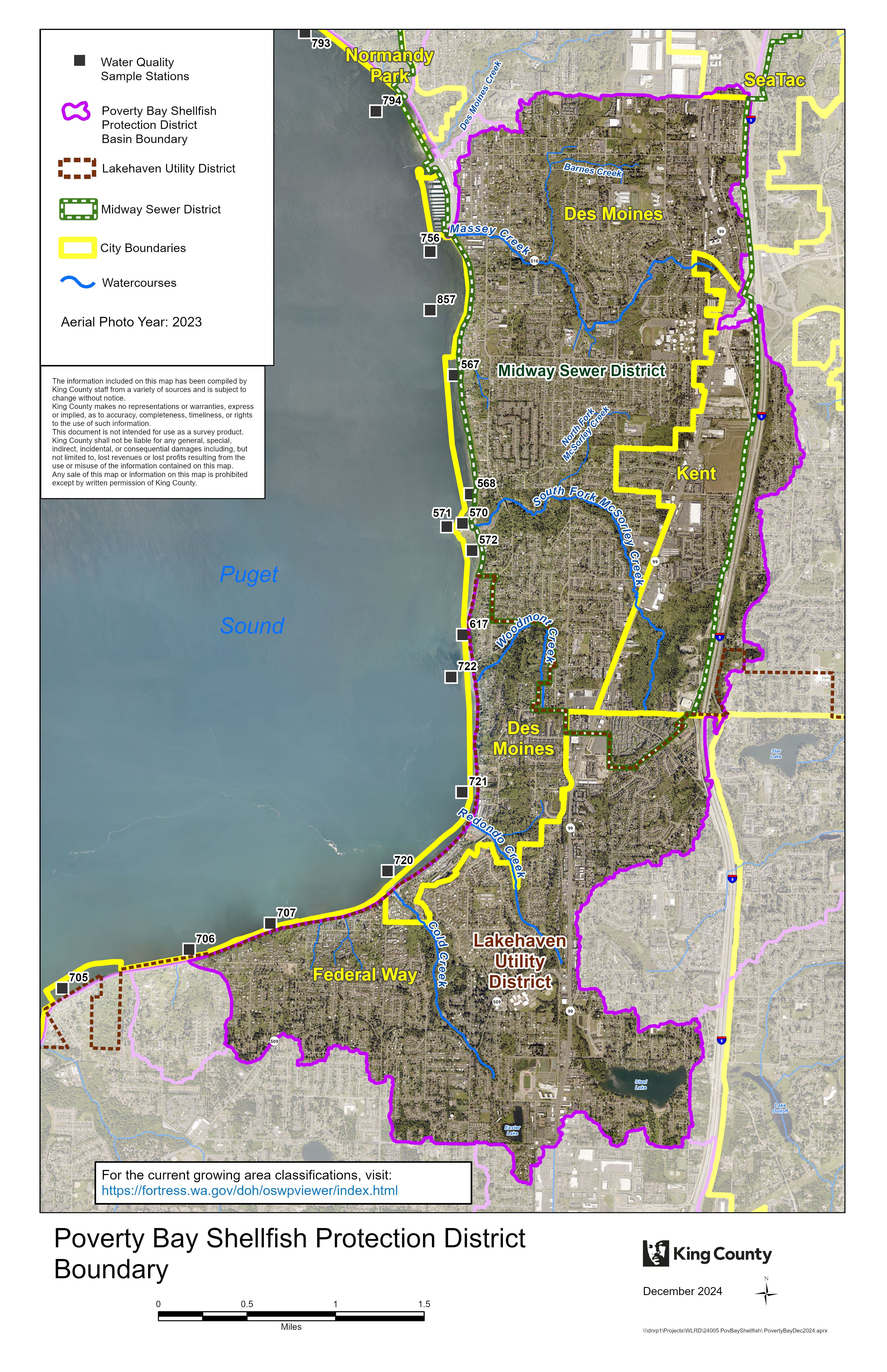
Poverty Bay Shellfish Protection District Boundary Map
The map below shows the Shellfish Protection District boundary. This district was approved by King County Council December 3, 2018 in accordance with RCW 90.72. The map includes existing shellfish harvesting beds, their harvest classification, and marine monitoring stations managed by Washington State Department of Health. In addition, the map identifies the primary watercourses and drainage areas within the Poverty Bay Shellfish Protection District boundaries.
Download a PDF (3.8 MB) of the map.
 Translate
